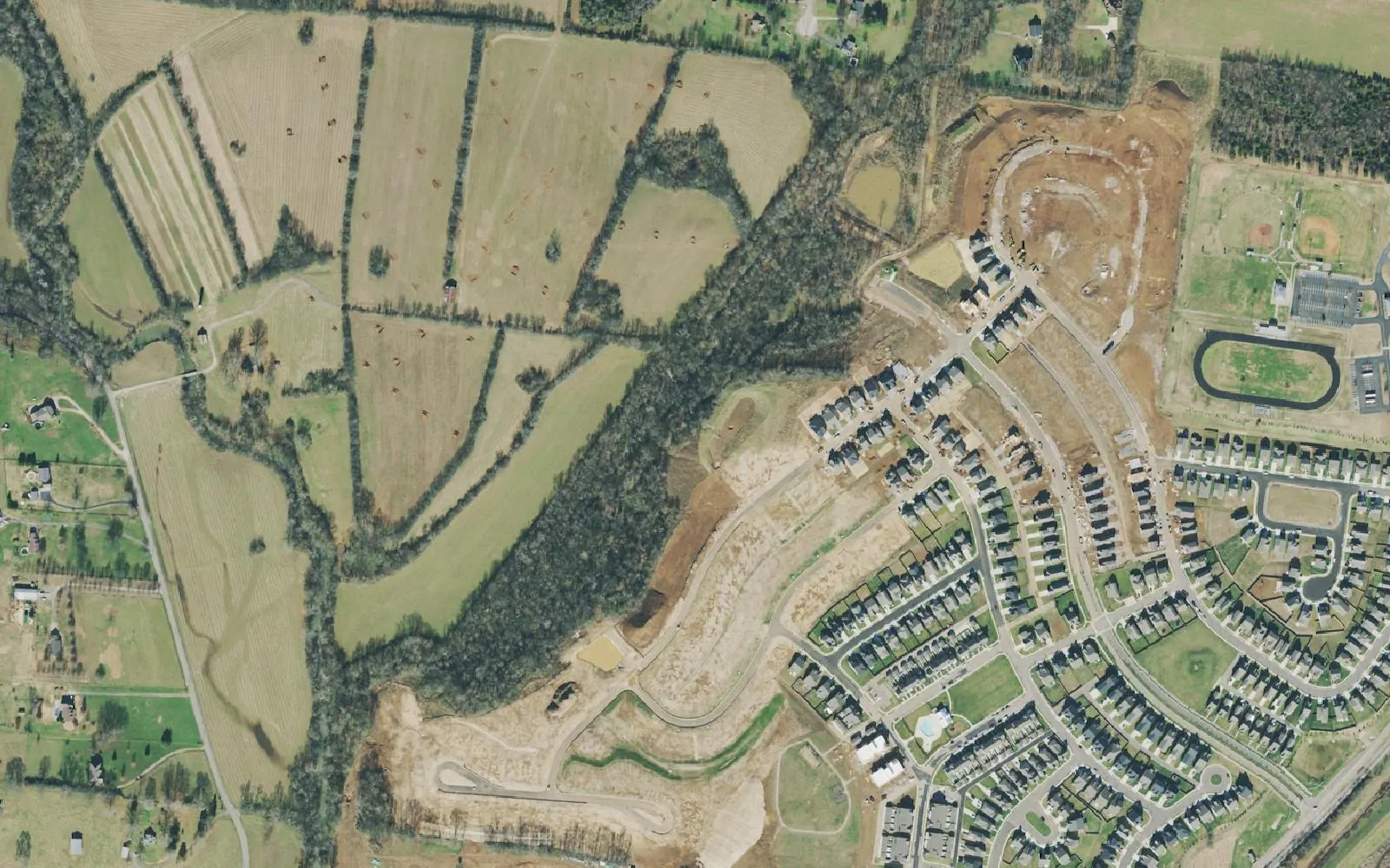
The west side of Spring Hill, off Beechcroft and Cleburne roads, holds Harvest Point and Spring Hill Middle. Zoned for Spring Hill High; Maury County.
Last checked Oct. 19, 2026. Sources: the City of Spring Hill’s public GIS map service (subdivisions, school zones, ZIP codes, wards, historic sites and public buildings layers), Maury County Public Schools’ zoned school finder, the Tennessee Department of Education’s 2024-25 letter grades, the Zillow Home Value Index (Zillow Research) and OpenStreetMap (© OpenStreetMap contributors).
The west side of Spring Hill is the land west of downtown reached by Beechcroft Road, which runs west from Main Street, and Cleburne Road, which runs north and south past Spring Hill Middle School. Harvest Point, the biggest subdivision here, was still being built in the 2021 aerial above; the city’s subdivision layer counts certificates of occupancy for 594 of its 1,250 approved units. All of it is in Maury County.
What this means for you
- Zoned high school: Spring Hill High, Maury County Public Schools (2024-25 state letter grade: C).
- Home value: $515,567 in ZIP code 37174 in September 2026, according to the Zillow Home Value Index.
- Nearest I-65 exit: Exit 53, Saturn Parkway, about 8.3 miles by road from Spring Hill Middle School.
Part of our Spring Hill neighborhoods guide.
Where it is
The city’s subdivision layer maps nine subdivisions here with about 2,325 approved housing units. Harvest Point (1,250 units) and Arbor Valley (581) account for most of them; the others are Barton Hills, Beechcroft, Meadows of Spring Hill, Beechcroft Station, Williamsburg and The Plantation. The Tennessee Children’s Home property also sits on this side of the city in the layer.
Main roads are Beechcroft Road, east-west, and Cleburne Road, north-south. OpenStreetMap marks the old crossroads community of Kleburne near Spring Hill Middle School. Everything here is in the city’s Ward 4. Most of the area is in ZIP code 37174; Barton Hills, at the south end, falls in Columbia’s 38401 on the Census Bureau ZIP map used by the city.
Two properties here are on the city’s historic sites list: the McKee House, 2224 Dr. Robertson Road, and the Polk House, 716 Beechcroft Road.
Maury County owners pay the Maury County rate plus the city rate: a combined $2.649 per $100 of assessed value for 2025, according to the Tennessee Comptroller’s 2025 Tax Aggregate Report. See property taxes.
Schools
All nine subdivisions are in the same zone on the city’s school zone layer. Grades are from the state’s 2024-25 A-F letter grade file:
| School | Address | 2024-25 grade |
|---|---|---|
| Spring Hill Elementary | 5359 Main St. | C |
| Spring Hill Middle | 3501 Cleburne Road | C |
| Spring Hill High | 1 Raider Lane (Columbia mailing address) | C |
Spring Hill Middle is inside the area, and Spring Hill High sits just to the south off Cleburne Road. Confirm an address in the MCPS zoned school finder and see full results on the Tennessee State Report Card. More in our schools guide.
Home values
Zillow’s typical home value for ZIP code 37174 was $515,567 in September 2026, up 0.4% from $513,611 a year earlier; the city figure was $518,832. Zillow’s 38401 figure, which covers mostly Columbia, was $371,173. The index is a modeled value for a typical mid-priced home, not a sale price, and is not published below the ZIP code level. More in home prices.
Parks and trails
The city runs no park inside this area. The nearest city park is Evans Park, 563 Maury Hill St., downtown, with shelters, a playground, ball fields and the Barkley Dog Park. The city’s planned trail network is in its Bicycle and Greenway Plan. See parks and trails.
Getting around
- Main roads: Beechcroft Road, Cleburne Road and Main Street (U.S. 31).
- Nearest I-65 exit: Exit 53, Saturn Parkway, by way of Main Street and Saturn Parkway.
- Distances by road from Spring Hill Middle School, measured on OpenStreetMap’s road network: about 2.7 miles to City Hall, 8.3 miles to the Saturn Parkway interchange and 40.2 miles to Nashville International Airport. These are distances, not drive times.
- Transit: there is no local bus; WeGo’s weekday Route 95 to Nashville leaves from the Spring Hill Kroger park-and-ride. See getting around.
Groceries and everyday stores
Neither the city’s shopping centers layer nor OpenStreetMap shows a supermarket inside the area. The nearest are Food Lion on Main Street downtown and the stores at The Crossings on Crossings Boulevard, including Target.
Related: downtown Spring Hill, Spring Hill neighborhoods and moving to Spring Hill.
Frequently asked questions
What is on the west side of Spring Hill?
The subdivisions off Beechcroft Road and Cleburne Road west of Main Street, the largest of them Harvest Point and Arbor Valley, plus Spring Hill Middle School at 3501 Cleburne Road. It is all in Maury County.
What schools is Harvest Point zoned for?
The city’s school zone layer puts Harvest Point and the rest of the west side in the Spring Hill Elementary, Spring Hill Middle and Spring Hill High zones. All three earned a C on Tennessee’s 2024-25 letter grades.
What ZIP code is Harvest Point in Spring Hill?
Harvest Point is in 37174, Spring Hill’s ZIP code. Barton Hills, at the south end of the area, falls in Columbia’s 38401 ZIP code on the Census Bureau map even though it is inside the city.
How far is the west side of Spring Hill from I-65?
From Spring Hill Middle School it is about 8.3 miles by road to the Saturn Parkway interchange at Exit 53 and about 2.7 miles to City Hall, measured on OpenStreetMap’s road network.
Have your say